
Yesterday my husband Paul and I completed the biggest challenge from my 2017 Cats Protection fundraising challenges (you can see all of them here: The Challenge). We walked 96 miles in five days, trekking the West Highland Way. Although we were well prepared (see my post on this here Trekking the West Highland Way) this was still an enormous challenge and I think we probably overestimated our abilities. In the end it was mental power that kept us going and got us to the finish.
Thank you to everyone who has sponsored us so far. If you would like to support us please visit our Just Giving page to donate to Cats Protection (https://www.justgiving.com/fundraising/rorysfelinegood). You can find more photos from the Trek on the Rory’s Feline Good Facebook Page (https://www.facebook.com/RorysFelineGood/).
Day 1 – Milngavie to Cashel Campsite
The West Highland Way starts in Milngavie, which is just north of Glasgow. We decided on an early start to give us plenty of time to complete our walk. The start of the WHW is marked by a stone obelisk. We met another walker here who kindly took our photograph.

The going was fairly easy and flat leaving Milngavie with good paths. We quickly left the town behind and ventured into country parks and wooded paths. Upon rounding a corner we suddenly went from pine trees to open moorland and got great views of Dumgoyne (the knobbly hill in the picture below) in the distance. Shortly after this we came across a pub, the Beech Tree Inn, where we didn’t have a drink, but did stop to pet their Shetland Ponies.

After further tracks through fields and on good path we reached the bottom of Conic Hill. This was our first real ascent of the walk and although it isn’t a challenging one it felt rather difficult after 16 miles of walking and carrying heavy packs! The views from the top over Loch Lomond are spectacular but the climb left us quite drained.

We descended Conic Hill and walked into the village of Balmaha, where we stopped for a meal and a pint at the Oak Tree Inn. There was a further 3 miles to walk to the campsite at Cashel and this proved to be through wooded paths with a lot of ups and downs. We were very happy to reach the campsite and rest up for the night. Feeling like real adventurers we even made some tea on our camping stove.
In total on day 1 we walked 22.7 miles (36.5 km). We were tired by the end of it but hadn’t encountered any real problems and were feeling ready to continue our trek,
Day 2 – Cashel Campsite to Beinglas Farm
We had the worst nights sleep. In an attempt to keep our packs as light as possible we picked a small 2 man tent. This was a rookie mistake because although there are only two of us we also had 2 large packs to fit in with us. Feeling very tired we continued with our walk.
The way continued through winding woodland paths, which whilst not overly demanding felt quite circuitous. We followed the edge of Loch Lomond in this way until reaching the town of Rowardennan where we filled up our water bottles. The woodland trail continued on from here and onto the town of Inversnaid, where we stopped at the hotel for some lunch. We were already struggling at this point, more from lack of sleep than anything, but decided to press on.

The path from Inversnaid to the end of Loch Lomond was the most difficult section of the whole WHW by a long stretch. At times it felt like it wasn’t a path at all, as we clambered over boulders and tree roots to make our way along. It was very slow going! It was a stunning wilderness though and a large portion of it passed through a RSPB reserve.
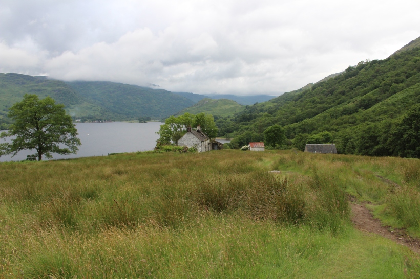
After this, towards the end of Loch Lomond we suddenly came out onto open ground. Here there was an abandoned farm house and also a bothy (a shelter that hikers can take refuge in and stay in overnight if they wish). We took a look in the bothy out of curiosity as another walker had told us about these buildings. It was pretty much an empty building, with some abandoned camping gear inside, but I’d imagine would be a welcome site for hikers caught in bad weather!
At the end of the Loch there was a steady ascent up a pleasant grassy path – a relief after the earlier woodland scramble. A walker we met earlier that day told us that on reaching the top of the hill we should take a small detour through a gate and go and sit on the rocks there. This proved to be worth it given the spectacular views over Loch Lomond.

From here we descended to Beinglas Farm camp site. The facilities here were great and the path actually passed right through it. The camp site had a good bar, which served up generous portions of food.
In total on day 2 we walked 19.1 miles (30.7 km). We were tired and a little foot sore by the end of it.
Day 3 – Beinglas Farm to Bridge of Orchy
The track leaving Beinglas was easy going but got rather muddy at points. Early in the walk I went into the mud and nearly lost my boot – we had to stop so I could change my socks and clean myself up a bit! For most of the day the path was near the main road (the A89) so it never felt like we were really in the wilderness.

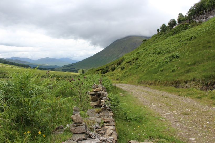
We crossed the river Fillan and followed a road through the countryside, stopping on the way for a bit of a rest. Here we saw the ruins of St. Fillan’s Priory and along the way were a number signs with information about the history and stories of the area. There was the site of the Battle of Dalrigh where Robert the Bruce suffered defeat in 1306 and also the Lochan of the Lost Sword, where according to legend he cast his sword following the battle.

We were in good spirits when we reached the town of Tyndrum and stopped for some fish and chips at the Real Food Cafe. After this we followed a broad stony track, which continued following the railway to Bridge of Orchy. At this point my ankle started to hurt quite badly and so although the path was easy we had to take our time.
We reached Bridge of Orchy and I had a big glass of wine at the hotel there. At this point I was convinced I was going to have to stop as my ankle was swollen and painful.
In total on day 3 we walked 19 miles (30.5 km). It had been easy going but I was feeling downhearted by the end of the day because of my ankle. I was worried I wouldn’t be able to complete the challenge.
Day 4 – Bridge of Orchy to Kinlochlevan
My ankle was still sore on waking but after putting on an ankle support and taking some paracetamol I felt ready to continue. The start of the way was a brief ascent through a forest path but after this we moved out into the open. The path here was broad and stony but fairly flat as it headed out across open expanse of Rannoch Moor. There were spectacular views of the mountains along the way.

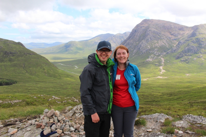
We followed this path until we reached Kinghouse where we stopped for lunch. After this was the real challenge of the day – the Devil’s staircase. This is a zigzag path, which took us to the highest point of the West Highland Way at 548m. Despite the name it was not as challenging as we thought it would be and there were amazing views at the top.
From this point the path seems to descend for a very very long time. We were weary and keen to reach our final campsite of the trek.

In total on day 4 we walked 21.6 miles (34.8 km). By this point our feet were really suffering and covered in blister plasters to try and protect them. Despite this we found this to be a very enjoyable day and felt good about completing our trek.
Day 5 – Kinlochlevan to Fort William
It rained overnight and was still raining when we set off in the morning. By this point I was limping and so we proceeded at more of a shuffle than a walk. I was determined having come so far that I would finish the trek though. The initial track ascended up from Kinlochlevan through forest track. The rain had caused some of the steams that we needed to ford to be larger than usual and our feet got very wet early on the walk. The rain continued throughout and we were soon soaked through despite our waterproofs.
After this the track continued into a wild landscape and into an area of felled trees. The rain and mist meant that there wasn’t much for us to see as we plodded on.

We continued the walk until it reached the Glen Nevis visitor centre at the base of Ben Nevis. Unfortunately we couldn’t really see much of this and so after taking a final break we struggled on into Fort William. Here we finally reached the end of the way and our five day trek.

In total on day 5 we walked 14.4 miles (23.2 km). This was by far the most difficult day, because of weather conditions but also because of the combination of foot, leg and ankle pain. We slogged on at a painfully slow 2mph and finally made it to the end.
Overall I’m pleased that we did this challenge. The highs far outweighed the lows and it was great to see more of the Scottish countryside. I think we’ll be spending the next few weeks doing as little as possible as we recover!
Thank you to everyone who has supported and sponsored us. It means a lot to us and also will do a lot to help Cats Protection continue their work to improve the welfare of cats and find good homes for all of those who need them.

Pingback: West Highland Way Trek – Complete | Rory's Feline Good
July 12, 2017 at 6:48 pm
Looks like a great hike!
LikeLiked by 1 person
July 12, 2017 at 6:51 pm
It was great but painful by the end! The most important thing is that we managed to raise some money for Cats Protection 😄
LikeLiked by 1 person